Tomahawk Lake - Fresno County
Fresno County (John Muir Wilderness)
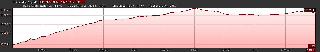
Distance (one way):
7.5
mi
Elevation Gain:
2639
ft
Starting Elevation:
9355
ft
Ending Elevation:
11153
ft
Max Slope:
46.7
%
Avg Slope:
8.8
%