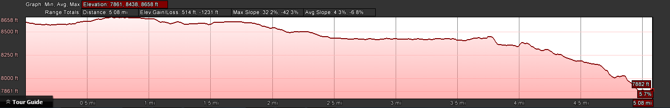
Mattie Lake - Tuolumne County
Tuolumne County (Yosemite Wilderness)
- Distance (one way):
- 5.08 mi
- Elevation Gain:
- -514 ft
- Starting Elevation:
- 8438 ft
- Ending Elevation:
- 7882 ft
- Max Slope:
- 32.2 %
- Avg Slope:
- 4.3 %
Day 1 - Hike to Glen Aulin High Sierra Camp
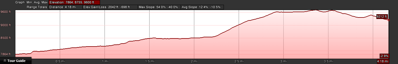
Day 2 - Hike to Mattie Lake
- Distance (one way):
- 4.18 mi
- Elevation Gain:
- +2042 ft
- Starting Elevation:
- 7864 ft
- Ending Elevation:
- 9212 ft
- Max Slope:
- 54.0 %
- Avg Slope:
- 12.4 %